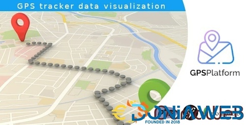
Service for visualizing data from GPS trackers. On our map you can see the path of the object of observation, its speed and other data. Free mobile apps and some GPS device models are supported. The user can switch the type of map: Google Maps, OpenStreet Maps or Yandex Maps. Also, the user can create a public page for his GPS device and receive a code for embedding on any site. The platform administrator can manage users, text pages, import and export data, etc.
Other files from Mahmoud
-
- 34 Downloads
- 5 {!#[1:comment][?:comments]}
-
- 38 Downloads
- 1 {!#[1:comment][?:comments]}
-
- 108 Downloads
- 2 {!#[1:comment][?:comments]}
-
- 2 purchases
-
- 45 Downloads
-
- 30 Downloads
- 1 {!#[1:comment][?:comments]}
-
Free
- 162 Downloads
- 3 {!#[1:comment][?:comments]}
-
- 17 Downloads
- 8 {!#[1:comment][?:comments]}
-
- 6 Downloads
- 1 {!#[1:comment][?:comments]}
-
- 4 Downloads
-
- 82 Downloads
-
- 44 Downloads
-
Free
- 49 Downloads
- 1 {!#[1:comment][?:comments]}
-
- 27 Downloads




.thumb.jpg.7e31f98f74eff0f78065a1e0a223d0b4.jpg)


.thumb.jpg.c52d275b7221c68f8316ff852d37a58f.jpg)
.thumb.png.bd6b18996437e081a647e5ea252dfb2b.png)

You may only provide a review once you have downloaded the file.
There are no reviews to display.